


On the heels of a cold front in the Midwest, a severe storm threat is present across more than five states in the region. FOX Weather Meteorologist Haley Meier analyzes the upcoming threat.
The Midwest is in the middle of an active week of weather that will continue as the weekend approaches.
On the heels of a powerful winter storm that will stretch across more than 1,000 miles, the ingredients for a potential class severe storm setup threaten millions in the Ohio Valley on Thursday.
SPRAWLING WINTER STORM STRETCHING 1,000+ MILES TO BRING DANGEROUS SNOW AND ICE ACROSS NORTHERN TIER
While much of the Northern Tier combats a strong winter packing snow and ice through Tuesday and on Wednesday, the growing threat of strong severe weather threatens millions in the Midwest as the combination of high wind shear and low instability will provide the necessary ingredients for severe thunderstorms that could produce tornadoes.
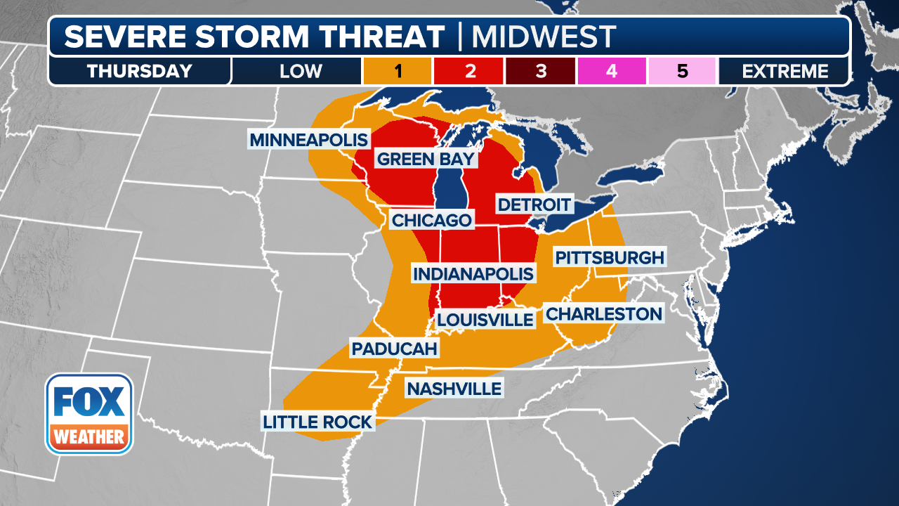
(FOX Weather)
A level 2/5 severe storm threat is in place across parts of Kentucky, Indiana, Ohio and Illinois, and includes a slew of major cities, including Cincinnati, Louisville and Indianapolis to name a few.
A larger 1/5 severe storm threat extends across a larger area in the Midwest, stretching into Missouri, Tennessee and West Virginia.
WHAT IS A SUPERCELL THUNDERSTORM?
According to the FOX Forecast Center, discreet supercells will be a concern in the afternoon hours and set the stage for the potential development of tornadoes.
This marks the first severe storm threat in the Ohio River Valley this year, as a large storm system from the Plains will drag warm humid air into the region that will provide the fuel necessary for severe weather.
According to the FOX Forecast Center, while the available energy may cause storms to struggle to intensify, the atmospheric lift will be more than enough to compensate to produce severe weather.
As the evening progresses, these storms will likely cluster into a line, shifting the primary threat toward damaging wind gusts.
By Friday, the primary system is expected to lose its punch as it crosses the Great Lakes.