


A major pattern shift is expected next week as a large dip in the jet stream parks over the West, allowing storms to originate there and track across the country into the East. This active setup will bring heavy mountain snow and abundant moisture to the West, while potentially increasing snow chances in the North and severe weather threats in the South.
As a cross-country storm forms in the West, another major shift in weather pattern will bring heavy mountain snow and abundant moisture while potentially increasing the chances of snow in the North, and severe weather threats in the South.
NEXT CROSS-COUNTRY WINTER STORM THREAT EMERGES AS WEATHER PATTERNS POTENTIALLY SHIFT
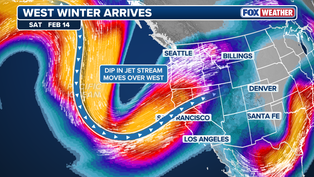
According to the FOX Forecast Center, a large dip in the jet stream will stall over the West starting next week. This will promote a ridge of high pressure to shift over to the East, reversing the weather pattern that has dominated much of the past month.
(FOX Weather)
A change in the weather pattern will open the door for more storm systems to originate in the West and strengthen across the Central U.S., eventually making their way to the East as more organized, large-scale and impactful storms.
However, it is too soon to tell how the ridge will evolve.
(FOX Weather)
If the area of high pressure becomes too strong, the storms could be pushed towards Canada instead.
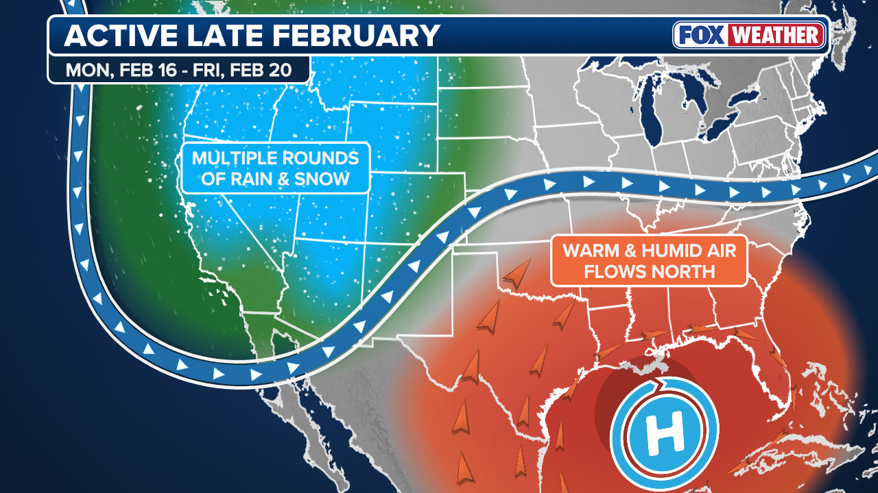
On the other hand, if the ridge weakens or moves farther south, it could cause impactful storms to move through the Midwest and into the Northeast.
This not only raises the chances of snow in the North, but can also increase the potential of severe weather in the South.
An area of high pressure in the South will promote warmer air and instability, fueling stronger thunderstorms.

A grandad pushes his grandchildren, from Oakland, at Northstar California Resort in Truckee, Calif., on Friday, March 1, 2024.
(Jane Tyska / Digital First Media / East Bay Times / FOX Weather)
HOW HIGH PRESSURE AND LOW PRESSURE DRIVE THE WEATHER
As for right now, one thing is for sure — the abundant moisture and mountain snow associated with the changed weather pattern.
The Climate Prediction Center claims that much of the West will see an above-average amount of precipitation through the end of February.
WINTER SEASON SEVERITY INDEX: WHICH PARTS OF THE US HAVE SEEN THE MOST INTENSE WINTER
The latest guidance shows that areas in the higher terrain, including the Rockies and Sierra Nevada, will experience at least 8 to 10 feet of snow by the end of February.