


Tropical Storm Lorenzo is maintaining it’s strength, and is forecast to perform an elongated clockwise loop getting wrapped around a large high pressure rather tracking straight out to sea. Lorenzo will not threaten land.
UPDATED Tuesday at 9 a.m. ET.
The tropical disturbance that moved off Africa over the weekend is slowly tracking west across the tropical Atlantic. It’s quite far south and east for a system this time of year, although occasionally these systems occur.
The consensus of the various computer forecasts is that the disturbance will track toward the Caribbean, arriving near the islands next Sunday or Monday. There is no indication in any of the models that the system would be strong at that time, but of course, it will bear watching. The current forecasts show a moisture surge moving into the southeast Caribbean across the Windward Islands.

Satellite image of Tropical Storm Lorenzo at 5 a.m. ET on Oct. 14, 2025.
(FOX Weather)
The longer-range projections generally keep the system in the Caribbean through next week, if it survives that far. The Caribbean waters are extremely warm, so it’s something we’ll keep an eye on.
Historically, most systems that cross the eastern Atlantic turn north this time of year, but there have been a few exceptions—notably, a hurricane in 1892 and Hurricane Iris in 2001.
Tropical Storm Lorenzo
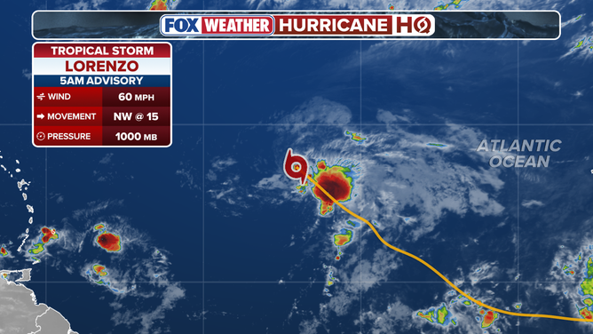
Statistics on Tropical Storm Lorenzo in the Atlantic.
Tropical Storm Lorenzo is moving north from the central tropical Atlantic. It’s being impacted by hostile upper winds and is not expected to strengthen very much while it loops and dies over open water.
The nor’easter
The big nor’easter that caused all the problems on the East Coast is moving away. Leftover rain in southeastern New England will move out soon. The storm will be absorbed by a huge North Atlantic low-pressure system in the next couple of days.
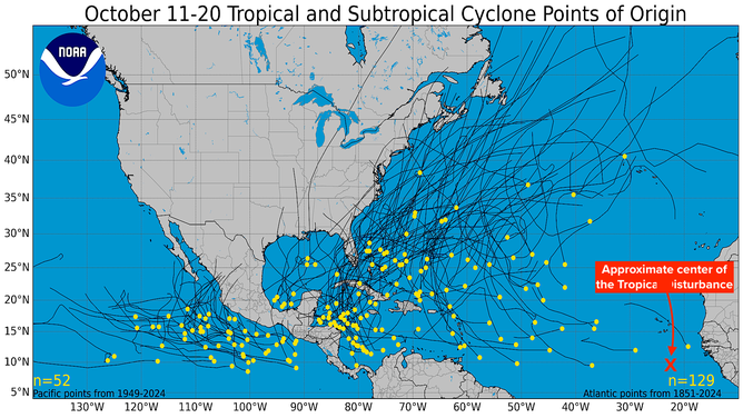
October 11-20 climate analysis.
The rest of the season
The giant low is part of the overall weather pattern that’s taking on a wintertime look. Strong dips in the jet stream are pushing into the tropics and creating a pattern hostile to tropical development. As long as the Caribbean waters are at summer temperatures, however, we can’t 100% rule out a system being pulled north. It’s too early to claim victory, but it’s encouraging.